Francis
|
Depth and Temperature |
||
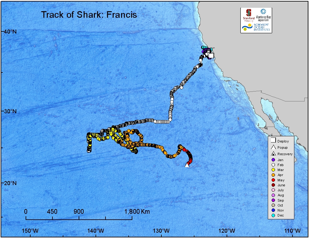
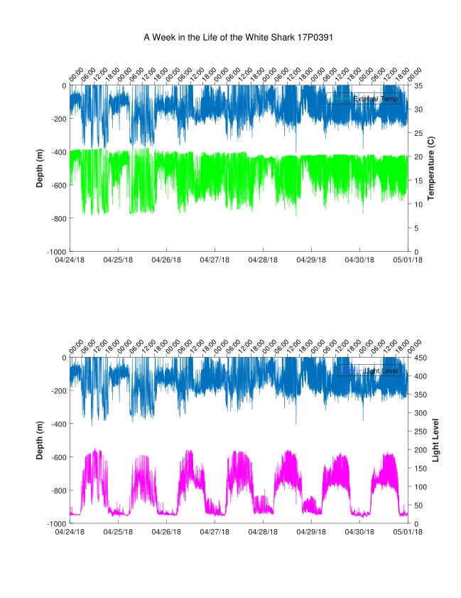
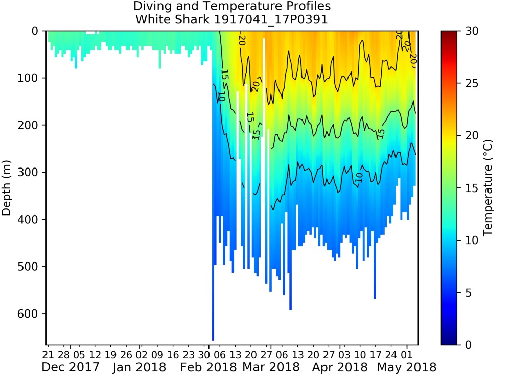
| This map shows the track the shark followed, color-coded by month. The locations are estimated using a combination of light levels, temperatures, and depths measured by sensors on the shark's tag. | These plots, taken from a recovered PAT tag, show a week in the life of a white shark. The top trace in each represents depth (blue) the green trace is temperature, and the magenta trace is light - showing the sunrise and sunset curves from which posiiton is calculated. | As the shark makes dives along its journey, its tag records temperatures at different depths - creating a profile of water temperatures throughout the water column. This has led to the idea of tagged animals acting as oceanographers - sampling the ocean at times and in places where it would be difficult or impossible for humans to go. |


